Port of Glasgow, Scottland
Today, the quayage of Glasgow is over ten miles in length, sufficient to berth forty or fifty ocean vessels at a time, and the total area of the harbor and docks includes over 181 acres of water.
Views from 1909
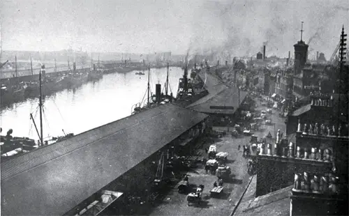
View of Glasgow Upper Harbour Looking Westward. GGA Image ID # 143fa29079
It is said that Glasgow made the Clyde, and the Clyde then made Glasgow. When one considers that in 1830, almost within memory of the present generation, navigation on the Clyde was hardly worth considering, the tonnage being but a little over 700,000, and that today, the number of sailing and steam vessels in and out of Glasgow per year is over 34,000, with the tonnage of over 12,000,000; and that the population of Glasgow has grown to over 600,000, one begins to realize what a tremendous influence a well-developed navigable river has upon the destiny of a city.
The great task of transforming and developing nearly twenty miles of the Clyde, from a narrow, shallow, tortuous stream, to a great navigable waterway has been, and still is, in charge of a board known as "The Trustees of the Clyde Navigation", constituted from 1809 to date, as follows:
- Prior to 1809: The Magistrates and City Council of Glasgow
- 1809-1825: The Lord Provost, Magistrates, and Council of the City of Glasgow as separate Statutory Trustees.
- 1825-1840: The Lord Provost, Magistrates, and Council of the City of Glasgow, and five other persons interested in the trade of the River and Firth of Clyde, nominated and appointed by them.
1840-1858:
- The Lord Provost of the City of Glasgow 1
- The Five Bailies 5
- The Dean of Guild 1
- The Deacon Convener 1
- Members of the Town Council 15
- The Chairman of the Chamber of Commerce 1
- Named by the Merchant's House 3
- Named by the Trade's House 2
- Named by the Bailies and Birleymen of the Barony of Gorbals 2
- Named by the Magistrates and Council of the Burg of Calton 1
- Named by the Magistrates and Council of the Burg of Anderson 1
- Total: 33
1858-1905:
- The Lord Provost of Glasgow 1
- Town Councilors of Glasgow chosen by the Town Council 9
- Representatives of shipping, mercantile, and trading interests of Glasgow, viz :
- Chosen by the Chamber of Commerce 2
- Chosen by Merchant's House 2
- Chosen by Trade’s House 2
- Elected by Ship-owners and Rate Payers 9
- Total: 25
1905:
- Chosen by the Corporation of the City of Glasgow 10
- Chosen by the County Council of Lanark 2
- Chosen by the County Council of Dumbarton 1
- Chosen by the Town Council of Govan 1
- Chosen by the Town Council of Patrick 1
- Chosen by the Town Council of Dumbarton 1
- Chosen by the Town Council of Renfrew 1
- Chosen by the Town Council of Clydebank 1
- Chosen by the Chamber of Commerce 2
- Chosen by the Merchant's House 2
- Chosen by the Trade's House 2
- Elected by the Rate-Payer Electors 18
- Total Members: 42
The detailed work of "The Trustees of the Clyde Navigation" is carried out through the following eleven standing committees and a large force of administrative officials and employees:
1. Management
2. Law and Parliamentary Bills
3. Finance
4. Superannuation Fund
5. New works and maintenance of Harbor and River
6. Workshops and Mechanical Appliances
7. Harbor and Graving Docks
8. Traffic and Storage
9. Ferries
10. Rates
11. Stores
The work of the Trustees as described by one of their officials, is principally:
1. Works
A. The Deepening and Straightening of the River Together with the Buoying and Lighting thereof
B. The continuation of riverside quayage, tidal basins, and graving docks, along with the equipment of the harbor with sheds, cranes and other appliances and tramways
C. The maintenance of the whole undertaking
2. Borrowing of Money
The Borrowing of money for capital purposes. The amount authorized by the Act of 1858, including all previous money authorized to be borrowed, was $7,309,440, and it has been increased till it is now over $34,000,000.
3. Rating
The levying of dues on all vessels and goods, and for the use of the various appliances, all within prescribed limits.
The most remarkable feature of the development of the Clyde, after the undertaking was transferred from the municipality to the Parliamentary Trustees under the Act of 1809, is the fact that Clyde navigation has be financed wholly on its own credit without either Government or Municipal assistance. While over $34,000,000 has be expended up this great project, only about four-fifths of this amount has been borrowed.
The progress in trade and the increase in revenue from $16,130 in 1880 to over $2,430,000 at present has given the investing public abundant confidence to furnish sufficient capital as needed to finance the great undertaking.
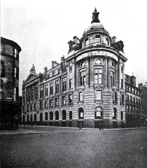
Clyde Navigation Trust Chambers. GGA Image ID # 1440a2f39c
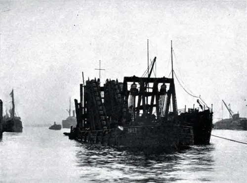
Dredger Working in Glasgow Harbor. GGA Image ID # 144103e1e1
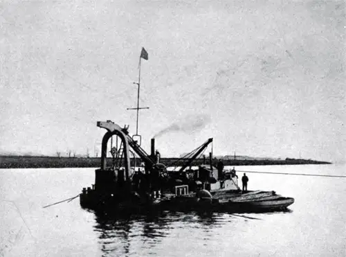
Diving Bell in the Harbor of Glasgow. GGA Image ID # 14413acd2d
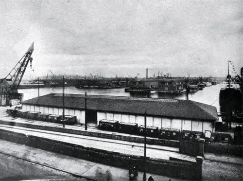
View of Princes Dock Looking Eastward Showing Double Story Sheds. GGA Image ID # 144140b8b8
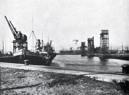
Inner Basin -- Rothesay Dock Looking Westward, Showing Coaling Hoists. GGA Image ID # 144164bb74
The River Clyde and its tributaries have a drainage area of about 1,400 square miles. It is about 102 miles in length from its source among the hills of Lanark County, 2,000 feet above sea level, to Port Glasgow.
The river falls rapidly from its source for about one half of the distance to Glasgow, passing through grazing and agricultural lands, and for the remaining distance, the river traverses rich mining and agricultural districts where the slope is much lighter.
The first report upon the improvement of the Clyde was made by John Smeaton in 1755, and while his report included by 5 1/2 miles of the river from Glasgow to Renfrew, he then found twelve shoals, four with but 18 inches and one with but 15 inches depth at low water.
The systematic improvement of the Clyde really commenced in 1772 under the advice of John Golbone and the authority of an act of Parliament empowering the Magistrates to deepen the Clyde between Glasgow and Dumbarton, to seven feet at high water of neap tides, and providing for a channel 300 feet in width.
Since that time this work has been carried on with a persistence and consistency almost unparalleled in the development of navigable rivers. The bed of the Clyde has been lowered from 24 to 28 feet for 20 miles, and since 1845 -- but little over a half century -- 75,679,695 cubic yards of material has been removed.
Today the Clyde has a depth of 22 feet at low, and 33 feet at high water, sufficient to float the great Luscitania from the Scottish shipyard on the banks of the Clyde, where she was built, on her maiden voyage to the sea.
It is interesting to note that the earlier engineers engaged in the improvement of the Clyde considered the width of the river too great for the depth and recommended that jetties be constructed to confine the flow and to obtain the benefit of the scouring action of the current.
Acting upon this advice, over 200 jetties were constructed along the upper reaches of the Clyde previous to 1800. This work was followed by the construction of low training walls connecting the jetties, the material dredged from the river by the early primitive methods being deposited behind these walls.
In the 1840 Act of Parliament, definite lines were established for the improvement of the river. In most cases they provided for widening to keep abreast of the increase in traffic and in the dimensions and draught of vessels which had grown from 13 1/2 feet in 1821 to 26 1/2 feet in 1900; but this Act also provided for the constriction of certain portions of the river and that all land reclaimed from the river should become the property of the riparian owners.
Later, much of the same land which had been reclaimed from the river had to be repurchased by the Trustees at great cost to provide sufficient width for the increasing requirements of Clyde navigation.
The material dredged was first used for reclaiming and making good agricultural land from the low waste land along the banks of the Clyde. Later, the dredgings were deposited at Loch Long, about 28 miles below Glasgow, and now they are carried to a new dumping ground at the mouth of the Firth about 46 miles from Glasgow Bridge.
The greatest natural obstacle encountered in the deepening and widening of the Clyde was the Elderslie Rock discovered in 1854 by the grounding of the "Glasgow", one of the earlier transatlantic steamers.
This obstruction was found to be a great mass of whinstone or trap rock extending entirely across the channel and underneath it for nearly 1,000 feet, the surface being but 8 feet below low water.
The plan adopted for removing this obstruction consisted of drilling and blasting under water and then of removing the debris by dredging. By 1880, the obstruction had been removed for one-half of the width of the channel to a depth of 14 feet below low water.
To complete this work, it required the drilling of 16,000 holes and the use of 76,000 pounds of explosives. Over 110,000 tons of rock and boulder clay were removed to obtain a 20-foot channel. This great undertaking was completed in 1886 at a total cost of $340,202.
The systematic dredging of the Clyde since 1824 has required a well organized force and a large amount of equipment. Starting with harrows, plows, and hand dredges, then advancing to the first steam dredger of 1824 with but 12-horsepower and a working depth of 13 feet, and from that down to twin-screw dredges 200 feet long by 37 feet broad capable of dredging 600 tons per hour and working to a depth of 40 feet of water.
The present dredging equipment of the Trustees consists of five dredges, two steam-digger barges, two diving bells, ten hopper barges of 1,200 tons, two of 1,000 tons, and seven of 400 tons capacity.
"The river is lighted by means of two lighthouses, three light-towers, tow lighted beacons, one lightship, and seven lighted buoys".
The Harbor of Glasgow includes that portion of the Clyde extending from Albert Bridge to the Kelvin River, a distance of about 21 1/2 miles. Its development commenced in a small way by the construction of quays along the river's border. In 1792, the total quayage was by 1,146 lineal feet and the total water area but four acres.
Today, the quayage of Glasgow is over ten miles in length, sufficient to berth forty or fifty ocean vessels at a time, and the total area of the harbor and docks includes over 181 acres of water.
The quayage is divided as follows:
+ Along the north side of the Clyde ... 12,561 Lineal Feet
+ Along the south side of the Clyde ... 10,425 Lineal Feet
+ Kingston Dock ... 2,469 Lineal Feet
+ Queen Dock ... 10,002 Lineal Feet
+ Prince's Dock ... 11,211 Lineal Feet
+ Rothesay Dock ... 5,541 Lineal Feet
Total: 52,209 Lineal Feet
The Rothesay and Queen's Docks are located in the northerly, and the Prince's and Kingston Docks on the southerly side of the Clyde.
Most of the quays are lined with modern one and two story sheds, usually built 15 or 20 feet back of the face of the quays, the total area of floor space being about 50 acres.
The Clyde Trustees do no warehousing or stevedoring business, all of this being carried on by private enterprise. The sheds are used wholly for goods in transit.
The Trustees own over 20 miles of railroad tracks connecting an elaborate system around the docks and warehouses with the various railway systems entering Glasgow.
The docks and warehouses are splendidly equipped with mechanical appliances, the Trustees having already provided forty-five steam cranes lifting from three to one hundred and thirty tons; fifty with hydraulic power, having a capacity of from two to one hundred and thirty tons; and twenty-two electric cranes capable of lifting from three to thirty-two tons.
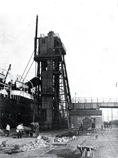
View of 25 Ton Coal Hoist at Princes Dock. GGA Image ID # 14416f3a6b
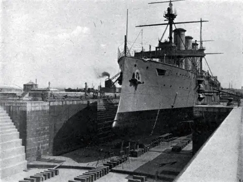
Graving Dock No. 3 Built in 1896 at a cost of $1,318,936. GGA Image ID # 1441784448
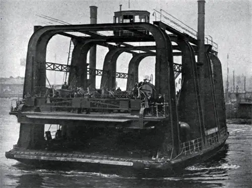
Vehicular Ferry Steamer with Elevating Platform. GGA Image ID # 1441c69a3f
The Glasgow Harbor is also provided with three graving docs, the first being built in 1875, the second in 1886 and the last in 1898. The Clyde banks are lined with great industries for several miles below Glasgow, and the sight from a steamer passing down the modern channel is one never to be forgotten. The tonnage of ships built by the large Clyde ship-builders has increased from less than 50,000 in 1860 to over 600,000 at the present time.
The Clyde Trustees operate ferries across, and steamers up and down the Clyde. While the ownership of property by the Trustees on the banks of the Clyde is much less complete than that of "The Mersey Docks and Harbour Board", at Liverpool, large areas have been purchased on both banks for a distance of nine miles from Glasgow, to provide for the future requirements of Clyde navigation.
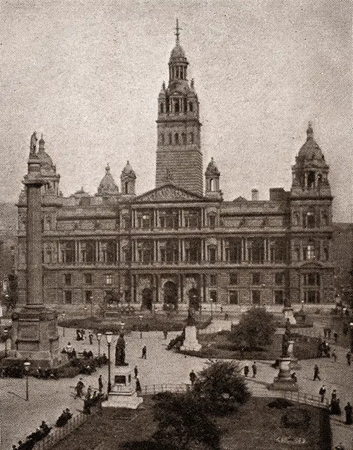
Glasgow, the Largest City in Scotland, Is a Place of Contrasts. A Mediaeval Cathedral, a University, and Great Steel-Ship Foundries Vie with Each Other in Interest. The Cameronia Was the First Oil-Burner to Make the Trip between Glasgow and New York. Going Abroad, 1923. GGA Image ID # 1bcb0b8647
Bibliography
The Port of Glasgow, Report of Connecticut Rivers and Harbors Commission To The General Assembly, Hartford, Published by the State 1911, Part II, A Study of Some Representative European Ports in the summer of 1909 by Frederick L. Ford, City Engineer, Hartford, CT, Pages 31-35.
